
Agricultural spraying, precision mapping, and conservation surveying
One local fleet covering everything from tassel-timing fungicide to wetland inventories. Every mission is flown by FAA Part 107 certified pilots and returned with full documentation.
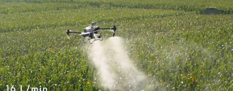
16 L/min Dual Atomizing Nozzle Output
Deep canopy penetration during tassel & bloom stages.
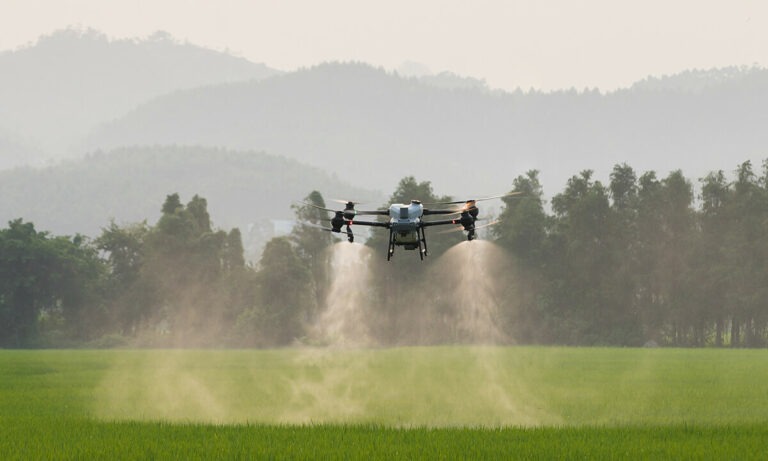
Zero Compaction Field Mobility
Flight line precision even when ground rigs cannot enter wet clay.
Agriculture Overseeing
Season-long crop scouting from above
Recurring multispectral flyovers that catch stand issues, pests, and moisture stress weeks before they show at eye level.
Learn moreFertilizer & Herbicide Application
Spread and spray without compaction
Dry spreading up to 50kg and liquid herbicide passes with zero wheel tracks, even on saturated or late-canopy fields.
Learn moreInsecticide Applications
Targeted pressure relief, fast
Rapid-response insecticide passes at 16 L/min with drift-controlled droplets and precise field boundaries.
Learn moreFungicide Applications
Canopy penetration when timing matters
Tassel-timing fungicide coverage with rotor downwash that drives product deep into the canopy.
Learn moreRoadside & Brush Management
Right-of-way control without a crew on the shoulder
Brush and invasive control along roads, ditches, fence lines, and utility corridors with no ground crew exposure.
Learn moreAerial Mapping & Surveying
Orthomosaics, NDVI, and volumetrics
Centimeter-accurate orthomosaics, elevation models, drainage analysis, and NDVI health maps for any parcel.
Learn moreAerial Photography & Videography
Show the operation the way it deserves
Cinematic 4K aerial photo and video for farms, agribusiness marketing, real estate, and events.
Learn moreEnvironmental Conservation & Surveying
Data for wetlands, habitat, and watersheds
Habitat inventories, wetland delineation support, invasive mapping, and restoration monitoring from the air.
Learn moreSearch & Recovery
Thermal eyes when time is short
Thermal and visual aerial search support for missing livestock, lost equipment, wounded game, and emergency response.
Learn morePurpose-built aircraft for every mission
Real payloads, real coverage rates, maintained and flown in-house.
DJI AGRAS T50
Primary spray & spread platform
- 50kg spreading / 40kg spraying
- 16 L/min dual atomizing nozzles
- Coaxial twin rotors, terrain-following radar
DJI AGRAS T40
Secondary spray platform
- 40kg spraying / 50kg spreading
- Up to 21 hectares per hour
- Binocular vision + omnidirectional radar
DJI Mavic 3 Multispectral
Mapping, scouting & NDVI
- 4 multispectral bands + RGB
- RTK centimeter positioning
- NDVI / NDRE prescription output