Precision Agricultural Drone Spraying, Seeding & Field Services
Michigan’s trusted custom aerial application service. We deliver zero soil compaction, RTK sub-inch accuracy, and rapid threshold response across row crops, orchards, and land management projects.
Agricultural & Land Management Drone Services
From tassel-stage corn fungicide and cover crop seeding to wetland mapping and roadside brush management, our certified team handles your application with precision.
Agriculture Overseeing
Season-long crop scouting from above
Recurring multispectral flyovers that catch stand issues, pests, and moisture stress weeks before they show at eye level.
Learn moreFertilizer & Herbicide Application
Spread and spray without compaction
Dry spreading up to 50kg and liquid herbicide passes with zero wheel tracks, even on saturated or late-canopy fields.
Learn moreInsecticide Applications
Targeted pressure relief, fast
Rapid-response insecticide passes at 16 L/min with drift-controlled droplets and precise field boundaries.
Learn moreFungicide Applications
Canopy penetration when timing matters
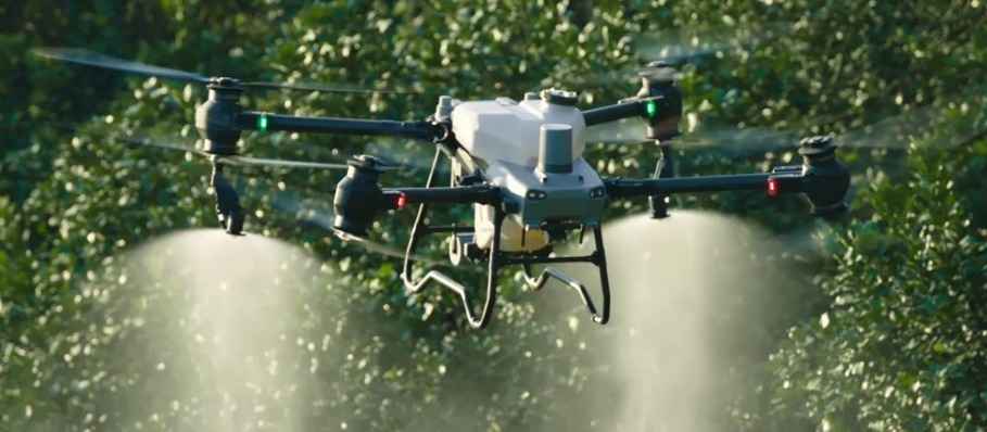
Tassel-timing fungicide coverage with rotor downwash that drives product deep into the canopy.
Learn moreRoadside & Brush Management
Right-of-way control without a crew on the shoulder
Brush and invasive control along roads, ditches, fence lines, and utility corridors with no ground crew exposure.
Learn moreAerial Mapping & Surveying
Orthomosaics, NDVI, and volumetrics
Centimeter-accurate orthomosaics, elevation models, drainage analysis, and NDVI health maps for any parcel.
Learn moreAerial Photography & Videography
Show the operation the way it deserves
Cinematic 4K aerial photo and video for farms, agribusiness marketing, real estate, and events.
Learn moreEnvironmental Conservation & Surveying
Data for wetlands, habitat, and watersheds
Habitat inventories, wetland delineation support, invasive mapping, and restoration monitoring from the air.
Learn moreSearch & Recovery
Thermal eyes when time is short
Thermal and visual aerial search support for missing livestock, lost equipment, wounded game, and emergency response.
Learn moreNeed a Custom Field Application Program?
We partner directly with growers, agronomists, co-ops, and land managers to tailor flight schedules, tank mixes, and prescription zone maps to your exact field boundaries.
See Precision Drones In Action
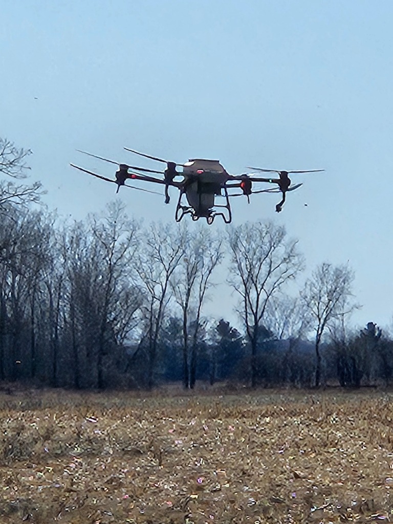
Watch real Michigan field passes: low-altitude atomized droplet spraying, cover crop interseeding into standing corn, and zero-compaction flight runs.
V10 Tassel Corn Fungicide Spray Pass
High-volume 16 L/min application penetrating tassel layer without stalk damage.
Cover Crop Rye Broadcast Interseeding
Aerial seeding cereal rye directly into standing V14 corn before harvest equipment enters.
Fence Line & Orchard Brush Penetration
Targeted downwash forcing spray deep into thick timber and overgrown fence lines.
Why Farms Choose Precision Drone LLC
Precision isn't just our name — it is our operating standard. Built on 4 generations of Thumb farming heritage and backed by commercial-grade aerospace technology.
RTK Sub-Inch Line Accuracy
Centimeter-precision RTK positioning ensures zero overlap, zero missed strips, and razor-sharp boundary control around sensitive crops.
Zero Soil Compaction Guarantee
Unlike 30-ton ground sprayers that crush standing crop and pack heavy Michigan clay, our aircraft touch zero soil, preserving 100% of yield potential.
16 L/min Dual Atomizing Nozzles
Mag-drive impellers atomize droplets for 3D canopy penetration, coating both top leaves and lower stalks where fungal spores germinate.
FAA Part 107 & MDARD Licensed
Operated by licensed commercial drone pilots adhering to strict FAA airspace rules and Michigan Department of Agriculture application standards.
How Precision Drone Application Works
A streamlined 5-step flight strategy built for accuracy, compliance, and maximum return on your chemical investment.
Assess Field & Objectives
We evaluate your field boundaries, crop stage, target pest or weed pressure, and local buffer requirements around homes or water.
Plan Precision Flight Strategy
We generate RTK-guided flight lines, droplet atomization spectrum parameters, and variable-rate prescription zones tailored to your crop.
Deploy Commercial Fleet
Our licensed pilots mobilize on site with high-capacity DJI AGRAS aircraft, applying product with zero ground compaction or wheel ruts.
Monitor Canopy Penetration
Dual atomizing nozzles drive product deep into the lower canopy using downward rotor downwash for 3D coverage.
Optimize & Provide Log Records
You receive time-stamped as-applied maps, flight logs, and multispectral verification records for your farm lender, insurer, or co-op.
Multispectral Crop Health & Stress Mapping
Identify nitrogen deficiency, disease pressure, and drainage stress 7 to 14 days before visible symptoms appear. We process 4 multispectral bands into prescription-ready maps for your sprayer or applicator.
- Prescription-ready zone maps as shapefiles, GeoTIFFs, or Deere Operations Center exports
- Early-season stand counts and replant mapping for row crops
- Tile drainage elevation contour mapping and wetland delineation
- Season-over-season comparative NDVI vigor indexing
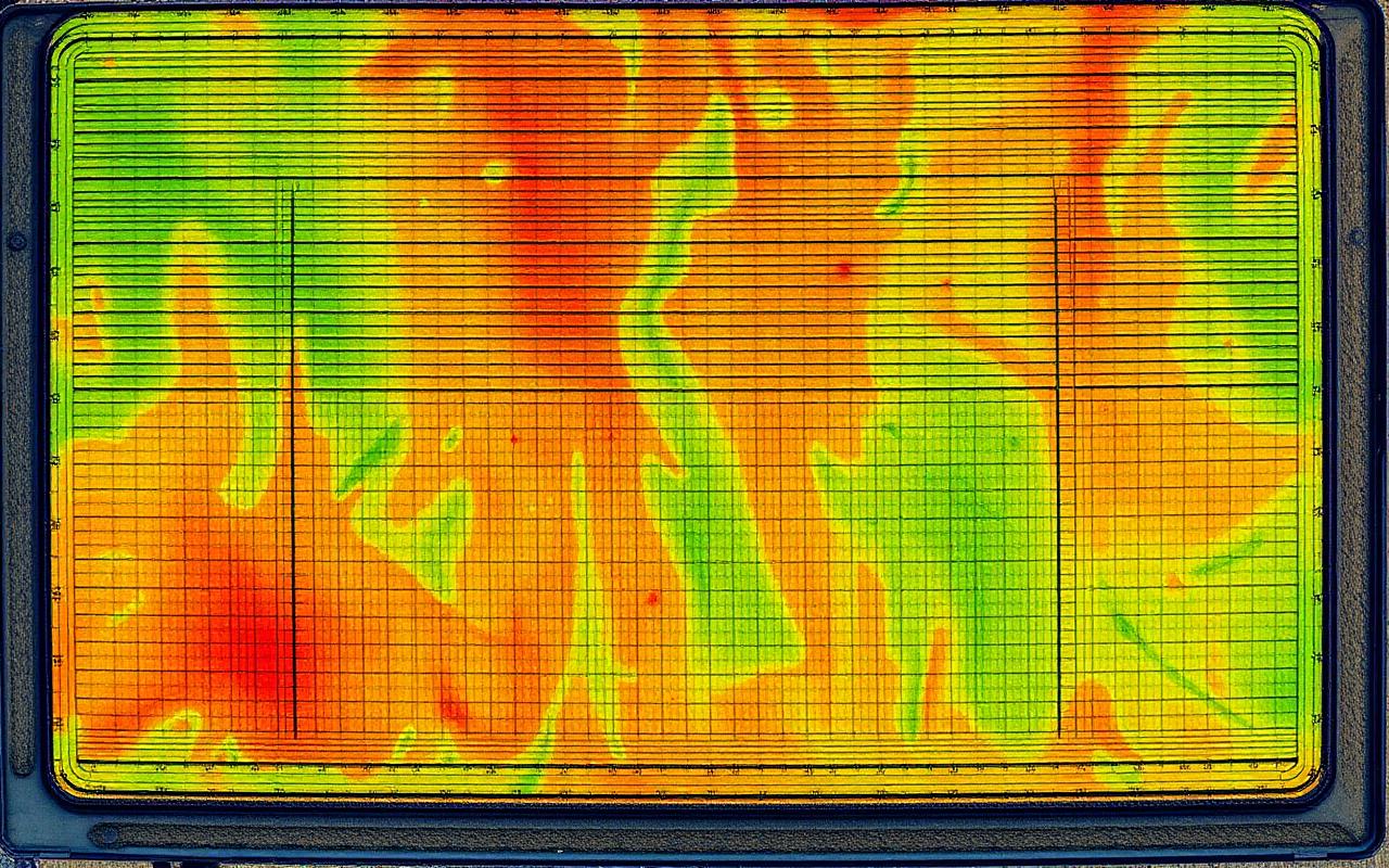
 RGBNDVI Multispectral
Drag to compare what your eyes see against what the Mavic 3M measures. Red and orange zones are losing vigor days before the canopy looks different from the road.
Fleet performance · DJI AGRAS T50 & T40 · Mavic 3 Multispectral
- 50 kg
- Spreading capacity
- 40 kg
- Spray capacity
- 16 L/min
- Spray rate
- 21 ha/hr
- Field coverage
- Mavic 3M
- Mapping payload
DJI AGRAS T50 dry payload
AGRAS T50 / T40 liquid tank
Dual atomizing nozzle output
Up to 52 acres per hour
Multispectral + RGB NDVI capture
Our Aircraft Fleet Specifications
Click any platform below to inspect payload metrics, spray flow rates, and specialized agricultural use-cases.
DJI AGRAS T50
Primary Heavy-Payload Application Aircraft
The crown jewel of precision agricultural application. Coaxial twin-rotor design delivers downward wind-wash that drives spray droplets deep into dense corn, soybean, and orchard canopies.
Payload Capacity
50 kg Spreading / 40 kg Spraying
Output Rate
16 Liters / Minute Dual Atomizing
Field Performance
Up to 52 Acres / Hour (Field)
Key Technical Capabilities
- Magnetic drive impeller pump with 16 L/min flow rate
- 50 kg dry broadcast spreader for cover crops & fertilizer
- Active phased array radar + binocular vision obstacle avoidance
- Sub-inch RTK flight line repeatability
Optimal Use-Cases
Where this aircraft delivers maximum return:
- ✓VT/R1 tassel-stage corn fungicide passes
- ✓High-volume dry fertilizer broadcasting
- ✓Cover crop rye interseeding into standing crops
Flown by FAA Part 107 certified pilots with RTK line precision.
Farming the Same Ground Since the Early 1900s
We aren't tech salesmen from out of state — our family farms Michigan's Thumb. We know what it means when a wet spring keeps ground rigs parked, or when tassel timing cannot wait. Precision Drone LLC was built to solve real farm problems with real commercial equipment.
4th
Generation family farm
100%
FAA Part 107 certified
0
Acres of soil compaction
Trusted Across Michigan's Thumb
Row crop growers, fruit orchard owners, and land managers rely on us season after season.
“Organic certification means every pass has to be documented and precise. Precision Drone maps my blocks, treats only the rows that need it, and sends me records I can hand straight to my inspector. They understand the rules as well as I do.”
Emily Thompson
Organic Vegetable Grower · Tuscola County, MI
Precision Agriculture & Technical Writing
Practical insights on drone spraying, chemical drift mitigation, cover crop interseeding, and local agricultural regulations.
Precision Drone LLC: Revolutionizing Agriculture and Conservation in Michigan
How a 4th-generation Thumb-area farming family traded guesswork for centimeter-accurate data and built one of Michigan's most capable agricultural drone fleets.
August 12, 2026 · 7 min readDronesWhy Michigan's Farmers and Conservationists Trust Precision Drone Services
Trust in custom application comes down to three things: showing up on time, staying inside the boundary, and handing over records that hold up. Here is how drones deliver all three.
July 28, 2026 · 6 min readConservationWhy Agricultural Drone Sprayer Companies are the Future of Sustainable Agriculture
Less product, no compaction, tighter buffers, and prescriptions built from actual field data. Sustainability and profitability point the same direction.
July 9, 2026 · 8 min readMichigan Agricultural Drone Answers & Guidance
Clear, extractable technical answers on drone chemical application, FAA Part 107 licensing, and local Michigan flight logistics.
Are your pilots FAA certified?
Yes. Every pilot holds an FAA Part 107 Remote Pilot Certificate, and our application work is covered by Part 137 agricultural aircraft operations authority plus Michigan commercial pesticide applicator licensing. We carry full liability coverage and can provide a certificate of insurance on request.
What weather conditions stop a flight?
We fly in winds up to roughly 12–15 mph depending on product and buffer requirements, and we stand down for steady rain, lightning within range, or temperature inversions that raise drift risk. Because we mobilize locally, we can often shift a job to an early-morning or evening window the same day instead of pushing it a week.
How do you handle chemical safety and drift?
Products are mixed on site by licensed applicators using label rates, with RTK-guided flight lines, controlled droplet spectrum, and mapped buffer zones around homes, surface water, pollinator habitat, and sensitive neighboring crops. You receive an as-applied map and full flight log after every mission.
What is your typical turnaround time?
Quotes usually go out within 24 hours. During peak season we are typically in the field within two to five days of approval, and threshold-driven insecticide work is often same-week. Mapping and NDVI deliverables are processed and returned within two to three business days of the flight.
Do I need to supply the chemical?
Either way works. Many growers supply product from their own program or through their local co-op, and we handle mixing and application. If you would rather we source it, we will quote product and application together.
What is the minimum field size?
There is no hard minimum. We regularly treat blocks under 10 acres, orchard rows, and right-of-way corridors where a ground rig or airplane simply is not practical. Small jobs are quoted with a minimum call-out that we will always state up front.
Never Miss a Critical Spray or Seeding Window
Sign up for hyper-local Michigan spray timing alerts. Get early notifications when VT/R1 tassel corn fungicide, soybean aphid threshold, or fall cereal rye interseeding windows open in the Thumb.