Unlocking the Power of Technology: The Role of Multispectral Imaging in Crop Health Monitoring
In the rapidly evolving world of agriculture, staying ahead of the curve means embracing innovative technologies that can transform traditional farming practices. Multispectral imaging, a cornerstone of precision drone services, is revolutionizing the way farmers in Michigan and beyond approach crop health monitoring. This cutting-edge technology, offered by Precision Drone LLC, enables detailed analysis of crop conditions, allowing farmers to detect issues like nutrient deficiencies and pest infestations before they impact yields. By integrating Michigan agriculture drones into their operations, farmers can make informed decisions that enhance productivity while promoting sustainable farming practices. Join us as we explore how multispectral imaging is unlocking new possibilities in farm drone technology, paving the way for more efficient and environmentally friendly agriculture.
{source=”unsplash” unsplashQuery=”agriculture, drones, technology, farming, multispectral imaging, crop monitoring, sustainability, precision agriculture” unsplashId=”vpfEhvI5UE4″}
## Understanding Multispectral Imaging
Multispectral imaging is a remarkable advancement in agricultural technology, offering farmers an unprecedented view of their fields. By capturing data across various light spectrums, this technology reveals intricate details about crop health that are invisible to the naked eye.
### Basics of Multispectral Technology
**Multispectral imaging** relies on sensors capturing data at specific wavelengths, often beyond the visible spectrum. *This allows for a more comprehensive analysis of the vegetation’s condition.* For farmers, understanding this technology begins with recognizing its ability to highlight variations in plant health.
1. **Sensors** capture data from different light bands.
2. **Data** is processed to create detailed maps of vegetation health.
3. **Interpretation** helps identify areas requiring intervention.
The technology’s precision enables early detection of issues, offering farmers the opportunity to address them before they escalate. This proactive approach not only saves time and resources but also supports sustainable farming practices, making it an invaluable tool in modern agriculture.
### Key Benefits for Agriculture
The benefits of multispectral imaging in agriculture are profound. By providing detailed insight into crop health, farmers can make informed decisions. **This technology enhances productivity and sustainability** through several key advantages.
– **Early Detection**: Identifies potential problems before they impact yields.
– **Resource Optimization**: Ensures efficient use of water and fertilizers.
– **Sustainability**: Reduces waste and promotes eco-friendly practices.
Farmers can thus focus resources where they’re needed most, enhancing overall productivity. Furthermore, the ability to monitor crops with precision leads to a reduction in the environmental footprint, aligning with global sustainability goals.
### Applications in Crop Monitoring
Multispectral imaging finds varied applications in crop monitoring. It allows for a detailed evaluation of plant health, soil conditions, and growth patterns. These insights are crucial for tailoring interventions.
**Real-World Example**: A Michigan farm utilized multispectral imaging to monitor crop growth. They identified nutrient-deficient areas early, applying targeted treatments that resulted in a 15% yield increase.
Such applications demonstrate the technology’s potential to transform agricultural practices, offering a clear path towards more efficient and productive farming operations. The data-driven approach ensures that interventions are both effective and sustainable.
## Enhancing Crop Health Monitoring
Crop health monitoring is critical for maximizing yields and maintaining sustainable farming practices. Multispectral imaging elevates this process, providing detailed insights that traditional methods cannot.
### Identifying Nutrient Deficiencies
Nutrient deficiencies can severely impact crop yields. Multispectral imaging aids in early identification, allowing farmers to address imbalances promptly.
– **Chlorophyll Levels**: Multispectral sensors detect variations in chlorophyll, indicating potential deficiencies.
– **Precision Treatment**: Targeted application of fertilizers reduces waste and cost.
By focusing on areas of deficiency, farmers can apply nutrients more effectively. This precision ensures healthier crops, translating to better yields and reduced environmental impact.
### Detecting Pest Infestations
Pest infestations pose a significant threat to crop health. Multispectral imaging offers a proactive approach to detection, enabling early intervention.
– **Infrared Imaging**: Detects heat patterns associated with pest activity.
– **Targeted Interventions**: Allows for precise application of pesticides.
Farmers can thus minimize pesticide use, reducing costs and environmental harm. This targeted approach also limits crop damage, ensuring high-quality yields.
### Monitoring Water Stress
Water stress is a critical factor in crop health, especially in regions prone to drought. Multispectral imaging helps monitor water levels, ensuring optimal irrigation.
– **Evapotranspiration Rates**: Sensors measure water loss, guiding irrigation schedules.
– **Efficient Water Use**: Reduces waste and improves crop resilience.
By optimizing water use, farmers can enhance crop health while conserving resources. This approach supports sustainable farming practices, aligning with broader environmental goals.
## Precision Drone Services in Agriculture
Precision drone services are revolutionizing agricultural practices. By integrating advanced technologies, these services provide farmers with the tools needed to enhance efficiency and productivity.
### Role in Precision Spraying
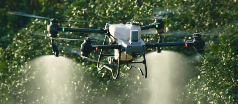
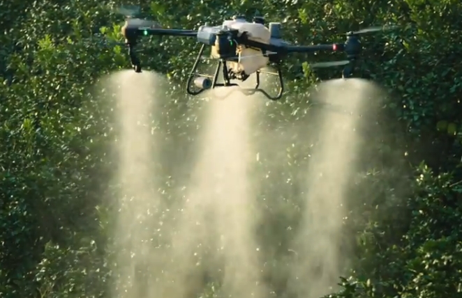
**Precision spraying** utilizes drones to distribute fertilizers and pesticides with remarkable accuracy. This technology minimizes waste, ensuring even coverage and effective application.
1. **Mapping**: Drones create detailed maps of fields.
2. **Targeting**: Identifies areas needing attention.
3. **Spraying**: Applies treatments precisely where needed.
This process reduces chemical use and costs, promoting sustainable practices. The ability to tailor interventions to specific areas also improves crop health, boosting yields.
### Importance of Aerial Mapping
Aerial mapping provides a comprehensive overview of agricultural landscapes. Drones equipped with advanced sensors gather data vital for decision-making.
– **3D Terrain Models**: Assist in land planning and development.
– **Infrastructure Assessment**: Facilitates irrigation and road planning.
Such mapping enhances resource management, helping farmers optimize land use. The detailed insights gained also support environmental conservation efforts, balancing productivity with sustainability.
### Efficiency in Land Surveying
Drone land surveying offers unparalleled precision and efficiency. This technology transforms traditional methods, delivering faster and more accurate results.
– **Time Savings**: Drones cover large areas quickly.
– **Data Accuracy**: High-resolution imaging ensures precise assessments.
The efficiency of drone surveying reduces labor costs and accelerates project timelines. Farmers and land developers benefit from reliable data, enabling informed decision-making.
## Environmental and Conservation Applications
Beyond agriculture, precision drone services play a crucial role in environmental conservation. These technologies provide valuable insights into ecosystem management and sustainability.
### Tracking Wildlife Movements
Drones equipped with thermal imaging are instrumental in tracking wildlife. This capability supports conservation efforts by providing detailed movement data.
– **Migration Patterns**: Monitors seasonal movements.
– **Habitat Usage**: Identifies critical areas for protection.
By understanding wildlife behavior, conservationists can develop strategies to protect species and preserve habitats, ensuring ecological balance.
### Assessing Environmental Impacts
Environmental surveying with drones provides essential data for impact assessments. This technology helps evaluate the effects of human activities on ecosystems.
– **Pollution Monitoring**: Detects areas of concern.
– **Habitat Degradation**: Identifies affected regions.
These insights guide mitigation efforts, supporting sustainable development. By minimizing environmental damage, drone surveys help balance progress with preservation.
### Supporting Conservation Initiatives
Drones offer new possibilities for supporting conservation initiatives. From monitoring deforestation to managing protected areas, they provide a vital tool for environmental management.
**Case Study**: A conservation project in Michigan used drones to monitor wetland restoration. The data collected informed management decisions, enhancing the project’s success.
Such applications highlight the potential of drone technology to drive positive environmental change. By integrating drones into conservation efforts, stakeholders can achieve greater efficiency and effectiveness.
## Future of Farm Drone Technology
The future of farm drone technology is bright, with innovations continually pushing the boundaries of what’s possible. These advancements promise to enhance agricultural practices further.
### Innovations in Drone Solutions
Ongoing innovations in drone technology are transforming agriculture. New features and capabilities are continually being developed, enhancing drone performance.
– **Advanced Sensors**: Improved data accuracy and detail.
– **Autonomous Operation**: Reduces the need for human intervention.
These innovations facilitate more efficient and effective farming practices. As technology evolves, drones will become even more integral to agriculture, offering new opportunities for growth.
### Expanding Agricultural Applications
The scope of agricultural applications for drones is expanding. Beyond traditional uses, new applications are emerging, driven by technological advancements.
– **Precision Planting**: Optimizes seed distribution.
– **Crop Pollination**: Enhances yield potential.
These applications highlight the versatility of drone technology in agriculture. By embracing new use cases, farmers can achieve greater efficiency and productivity.
### Sustainability and Efficiency Goals
Sustainability and efficiency remain central goals in the development of farm drone technology. By reducing resource use and environmental impact, drones support sustainable practices.
– **Resource Optimization**: Minimizes waste and cost.
– **Environmental Stewardship**: Promotes eco-friendly practices.
Through continued innovation, drones will play an increasingly vital role in achieving these goals. Their ability to enhance efficiency while supporting sustainability positions them as key tools in modern agriculture.
{source=”unsplash” unsplashQuery=”agriculture, drone technology, crop monitoring, precision farming, sustainability, multispectral imaging, environmental conservation” unsplashId=”XYrjl3j7smo”}
