The Role of Drones in Conservation: Enhancing Sustainability with Precision Drone LLC
In an era where sustainability is becoming increasingly crucial, the role of technology in conservation is more significant than ever. Precision Drone LLC is at the forefront of this movement, transforming agricultural and environmental management with their state-of-the-art drone services. By offering precise monitoring and targeted applications, they provide innovative solutions that not only optimize crop health but also bolster natural resource management. These advancements in agricultural drone service empower stakeholders to make informed decisions, ensuring both productivity and environmental stewardship. Join us as we delve into how Precision Drone LLC is enhancing sustainability and supporting Michigan’s vital agricultural and environmental sectors.

Introduction to Drone Technology
Drones have evolved from simple remote-controlled devices to complex systems with numerous applications. Their integration into conservation and agriculture signifies a pivotal shift in how we manage natural resources and food production. This section explores the evolution of drone technology and offers an overview of Precision Drone LLC’s contributions.
Evolution of Drone Technology
Drone technology has advanced significantly over the past decade. Initially used for military applications, drones have expanded into commercial and private sectors. Their capabilities have grown to include high-resolution imaging, GPS-guided navigation, and advanced data processing.
Early drones were limited in range and function, but today, they are equipped with sophisticated sensors and cameras, allowing for detailed aerial surveys and real-time data analysis. This evolution has broadened their use in agriculture and conservation, where they are invaluable for monitoring crop health, surveying wildlife, and assessing environmental conditions.
Key advancements include improvements in battery life, enhanced connectivity, and better flight stability. These innovations have made drones more accessible and efficient for everyday use. Precision Drone LLC has been at the forefront of these developments, offering state-of-the-art solutions tailored to specific needs.
Precision Drone LLC Overview
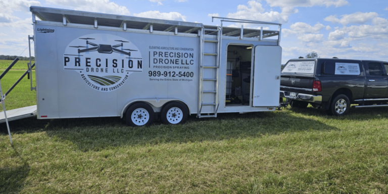
Precision Drone LLC stands out in the drone industry by focusing on sustainability and innovation. Their services are designed to support both agricultural productivity and environmental conservation, providing clients with precise and reliable data.
Founded on the principles of accuracy and efficiency, Precision Drone LLC delivers a range of services from aerial mapping to environmental monitoring. Their technology allows for real-time analysis and decision-making, empowering users with actionable insights.
What sets them apart is their commitment to client satisfaction and continuous improvement. They offer customized solutions and training to ensure that clients can fully leverage their services. With a focus on sustainable practices, Precision Drone LLC is a leader in integrating drone technology into traditional industries.
Revolutionizing Agriculture
Drones are revolutionizing agriculture by offering innovative ways to monitor and manage crops. This section delves into how drones enhance crop health, the precision application techniques used, and a look at agriculture drone services pricing.
Enhancing Crop Health
Drones play a crucial role in enhancing crop health. Equipped with advanced sensors, they can detect issues such as pest infestations or nutrient deficiencies long before they are visible to the naked eye.
By capturing high-resolution images, drones provide detailed insights into crop conditions. This allows farmers to take preventive measures, such as targeted pest control or precise nutrient application, reducing waste and improving yield.
Regular monitoring helps in maintaining optimal crop health. Drones can cover large areas quickly, ensuring that every part of the field is monitored consistently. This leads to healthier crops and better harvests, ultimately increasing profitability for farmers.
Precision Application Techniques
Precision application techniques allow for targeted treatment of crops, minimizing waste and environmental impact. Drones can apply fertilizers, pesticides, and other treatments with unparalleled accuracy.
Mapping and Analysis: Drones first map the area to identify specific needs.
Targeted Application: Based on the analysis, drones apply treatments only where necessary.
Efficiency and Sustainability: This method conserves resources and reduces chemical runoff.
The benefits of precision application include reduced input costs and improved environmental outcomes. By only applying necessary treatments, farmers can ensure sustainable practices while maintaining productivity.
Agriculture Drone Services Pricing
Understanding the pricing structure of agriculture drone services can help farmers budget effectively. Prices vary based on the complexity of services and the technology used.
Service Type | Estimated Cost Range |
|---|---|
Basic Monitoring | $500 – $1,000 per session |
Advanced Surveying | $1,000 – $2,500 per session |
Precision Application | $1,500 – $3,000 per session |
Factors influencing cost include the size of the area covered, the type of drones used, and the specific services required. Precision Drone LLC offers competitive pricing, ensuring value for money while delivering top-notch services.
Conservation Efforts with Drones
Drones are an asset in conservation efforts, aiding in natural resource management and environmental surveys. This section discusses their role in managing natural resources and conducting critical surveys.
Natural Resource Management
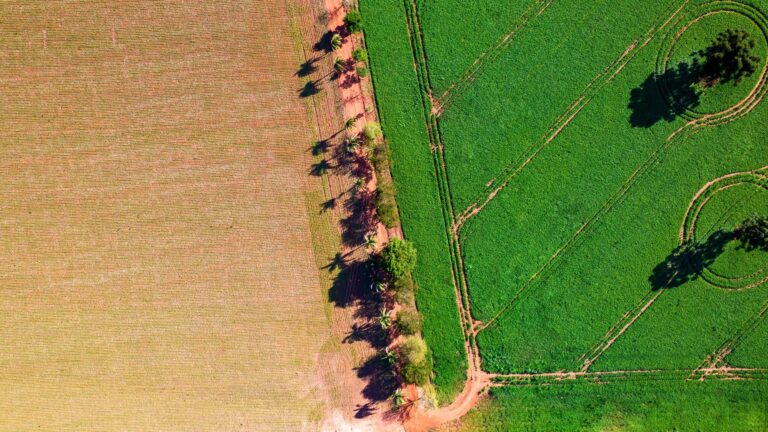
Natural resource management benefits greatly from drone technology. Drones provide a bird’s-eye view, making it easier to monitor ecosystems and track changes over time.
By using drones, conservationists can assess the health of forests, wetlands, and other natural areas. This data is crucial for developing strategies to protect and restore these ecosystems.
Key uses include monitoring deforestation rates, mapping biodiversity hotspots, and tracking the impact of human activities. Drones offer a cost-effective and efficient way to gather this information, supporting informed decision-making.
Critical Environmental Surveys
Critical environmental surveys are essential for understanding and protecting our planet. Drones enhance these surveys by providing accurate and comprehensive data.
Their ability to access remote areas allows for detailed mapping and analysis of diverse environments. This information is used to assess the impact of natural disasters, monitor wildlife populations, and plan conservation efforts.
Benefits of drone surveys include increased accuracy, reduced human risk, and improved data collection. By providing precise data quickly, drones enable timely interventions in conservation projects.
Improving Efficiency and Sustainability
Drones improve efficiency and sustainability through comprehensive monitoring solutions and aerial surveillance. This section explores how these technologies benefit various industries.
Comprehensive Monitoring Solutions
Comprehensive monitoring solutions offered by drones enable detailed observation of large areas. This capability is particularly useful in agriculture and conservation.
Drones equipped with cameras and sensors can perform continuous surveillance, detecting changes and potential issues rapidly. This allows for proactive management, reducing the risk of significant problems.
The advantages of these solutions include increased accuracy and timeliness of data, which are critical for effective resource management. By providing a complete picture, drones help stakeholders make informed decisions that enhance sustainability.
Benefits of Aerial Surveillance
Aerial surveillance offers numerous benefits, including broader coverage and improved data quality. Drones can quickly cover extensive areas, providing a comprehensive view that ground surveys cannot match.
This capability is essential for tasks like assessing crop health, monitoring wildlife, and evaluating environmental changes. The data collected is often more detailed and accurate than traditional methods.
Advantages of aerial surveillance include cost savings, increased safety, and enhanced data collection. This technology allows for better resource allocation, supporting sustainability and efficiency across industries.
Supporting Michigan’s Sectors
Precision Drone LLC’s drone technology supports Michigan’s agricultural and environmental sectors by offering innovative solutions and advancements. This section highlights the impact on these critical areas.
Agricultural Sector Advancements
Agricultural advancements in Michigan benefit significantly from drone technology. Precision Drone LLC provides services that enhance productivity and sustainability.
By offering detailed insights, drones help farmers optimize crop management and increase yield. This leads to higher profitability and more sustainable farming practices.
Key impacts include improved resource management, reduced environmental impact, and increased competitiveness. Precision Drone LLC’s solutions empower farmers to meet the challenges of modern agriculture effectively.
Environmental Sector Innovations
Innovations in the environmental sector are driven by the integration of drones. These tools enable better monitoring and management of natural resources in Michigan.
Through advanced imaging and data analysis, drones provide critical insights into ecosystem health and biodiversity. This information supports conservation efforts and policy-making.
The benefits include enhanced data accuracy, timely interventions, and improved outcomes for biodiversity. Precision Drone LLC’s drone services play a vital role in advancing environmental sustainability in the region.