In the modern agricultural and environmental sectors, visual data plays a crucial role in planning, monitoring, and promoting various projects. Aerial photography and videography provide unique perspectives and detailed insights that ground-based methods simply cannot match. Precision Drone LLC offers professional drone services specializing in high-quality aerial imaging for a wide range of applications in Michigan. This blog post explores the benefits and uses of aerial photography and videography, highlighting how this technology supports agricultural and environmental initiatives.
The Advantages of Aerial Photography and Videography
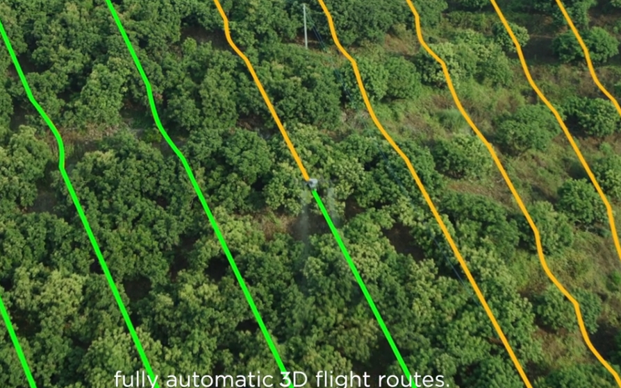
1. Comprehensive Coverage and Perspective: Drones equipped with high-resolution cameras, such as those used by Precision Drone LLC, can capture expansive views of large areas. This capability is particularly beneficial for agricultural and environmental projects, where understanding the layout and condition of the land is essential. Aerial views provide a comprehensive perspective, allowing stakeholders to see the big picture and make informed decisions.
2. High-Resolution Imaging: Our drones deliver stunning 4K UHD video and high-resolution photos, capturing intricate details that are often missed from the ground. This clarity is invaluable for tasks such as assessing crop health, monitoring wildlife, or documenting changes in land use. High-quality images and videos are also essential for creating detailed maps and models, supporting accurate analysis and reporting.
3. Time and Cost Efficiency: Aerial photography and videography can significantly reduce the time and cost associated with traditional ground-based surveys. Drones can quickly cover large and difficult-to-access areas, providing rapid data collection and reducing the need for extensive manual labor. This efficiency is especially valuable in Michigan’s diverse agricultural landscapes, where time-sensitive decisions can impact crop yields and conservation outcomes.
4. Enhanced Communication and Marketing: Visual content is a powerful tool for communication and marketing. High-quality aerial images and videos can be used to showcase the beauty and scale of agricultural projects, promote eco-tourism, or highlight conservation efforts. For farmers and environmental organizations in Michigan, this content can enhance public outreach, attract funding, and build community support.
Applications of Aerial Photography and Videography
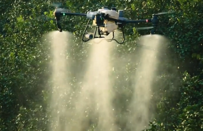
1. Agricultural Monitoring and Planning: Aerial imaging provides detailed views of crop fields, allowing for the assessment of plant health, soil conditions, and irrigation systems. This information is critical for precision agriculture practices, which aim to optimize inputs and maximize yields. By identifying issues early, such as pest infestations or water stress, farmers can implement targeted interventions, reducing costs and minimizing environmental impact.
2. Environmental Conservation: For conservation projects, aerial photography and videography offer a non-invasive way to monitor wildlife, track changes in vegetation, and assess the impact of human activities on natural habitats. This technology is particularly useful in Michigan, where diverse ecosystems require careful management and protection.
3. Land Use and Urban Planning: Drones provide valuable data for land use planning and urban development, offering clear views of landscapes, infrastructure, and natural resources. Aerial imaging can help planners design sustainable developments, manage natural resources, and ensure compliance with environmental regulations.
4. Marketing and Public Relations: High-quality aerial visuals are an asset for marketing and public relations efforts. They can be used in promotional materials, social media campaigns, and presentations to showcase projects, highlight successes, and engage stakeholders.
Conclusion
Aerial photography and videography are transformative tools for agriculture and environmental management, providing essential data and stunning visuals that support a wide range of applications. At Precision Drone LLC, we are committed to offering top-tier aerial imaging services to Michigan’s agricultural and environmental sectors. Our expertise in drone technology ensures that you receive the highest quality visuals and insights for your projects.
If you are interested in enhancing your agricultural or environmental projects with professional aerial photography and videography, contact Precision Drone LLC today. Let us help you capture the full potential of your land and initiatives with our advanced drone services.


