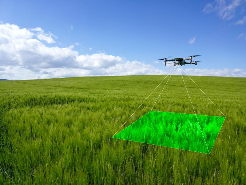
Accurate mapping and surveying are essential components of effective land management in agriculture, conservation, and construction. Traditional methods of land surveying can be time-consuming, labor-intensive, and sometimes less precise. At Precision Drone LLC, we offer advanced aerial mapping and surveying services using cutting-edge drone technology. This blog post explores how drones are transforming land management practices by providing detailed and accurate data, leading to better decision-making and more efficient operations.
The Benefits of Aerial Mapping and Surveying with Drones
1. Precision and Detail: Drones equipped with high-resolution cameras and advanced sensors can capture detailed images of the terrain from above, providing a level of precision that traditional ground-based methods often cannot achieve. At Precision Drone LLC, our drones, including the DJI AGRAS T50, deliver crisp, high-resolution aerial imagery that is crucial for creating accurate maps and surveys.
2. Efficiency and Coverage: One of the standout advantages of drone surveying is the ability to cover large areas quickly and efficiently. This is particularly beneficial for agricultural operations, large conservation areas, and construction sites where traditional surveying methods would be impractical or too time-consuming. Drones can fly over vast expanses of land, capturing comprehensive data in a fraction of the time it would take using manual methods.
3. Accessibility to Difficult Terrain: Drones can access and survey difficult or hazardous terrain that might be challenging or dangerous for human surveyors. This includes steep slopes, dense forests, wetlands, and other inaccessible areas. By providing a safe and efficient way to gather data from these regions, drones enhance the scope and accuracy of land surveys.
Applications of Drone-Based Mapping and Surveying
1. Agricultural Planning and Management: In agriculture, accurate mapping is essential for planning and managing crops. Drones can create detailed maps that show variations in soil composition, crop health, and moisture levels. This data helps farmers optimize planting strategies, manage irrigation systems more effectively, and make informed decisions about fertilization and pest control.
2. Conservation and Environmental Monitoring: For conservationists and environmental scientists, drones offer a powerful tool for monitoring ecosystems, tracking changes in land use, and assessing the health of natural habitats. High-resolution aerial imagery can reveal subtle changes in vegetation, detect the presence of invasive species, and help in the management of protected areas.
3. Construction and Infrastructure Development: In the construction industry, drones are used for site surveying, progress monitoring, and infrastructure inspection. They provide up-to-date aerial views that help project managers track the development of construction sites, identify potential issues early, and ensure that projects are on schedule and within budget.
Enhancing Decision-Making with Accurate Data
The detailed data provided by drone surveys is invaluable for making informed decisions in various fields. Whether it’s optimizing agricultural practices, planning conservation strategies, or managing construction projects, the high-quality data obtained from drone mapping allows stakeholders to analyze the landscape with precision and clarity. This leads to better resource management, cost savings, and improved outcomes.
Conclusion
Aerial mapping and surveying with drones is a transformative tool for land management, offering unparalleled precision, efficiency, and safety. At Precision Drone LLC, we are dedicated to providing top-tier drone services that meet the diverse needs of our clients, from farmers and conservationists to construction professionals. Our expertise in drone technology ensures that you receive the most accurate and actionable data for your projects.
If you are interested in learning more about our aerial mapping and surveying services, contact Precision Drone LLC today for a consultation. Let us help you transform your land management practices with the power of drone technology.


